

Green Laser Distance Sensor Integrated with GNSS for High-Precision Positioning and Measurement
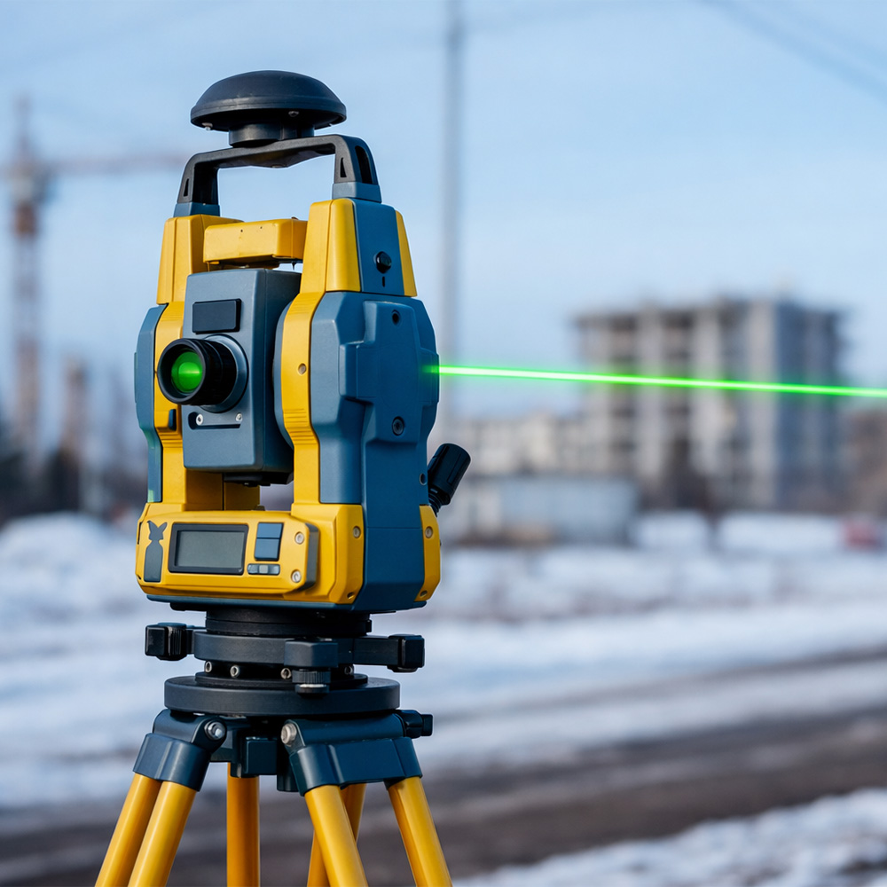
In recent years, the integration of green laser distance sensors with GNSS systems has become an important development in high-precision positioning and measurement technologies. By combining the accurate distance measurement capability of laser sensors with the global positioning ability of GNSS, engineers and researchers can achieve more reliable and efficient spatial data collection.
This technology is increasingly used in fields such as surveying, smart infrastructure, UAV mapping, construction automation, and precision agriculture. A green laser distance sensor provides highly visible laser signals and precise distance measurement, while GNSS (Global Navigation Satellite System) ensures accurate geographic positioning. Together, these technologies create a powerful solution for modern geospatial applications.
What Is a Green Laser Distance Sensor?
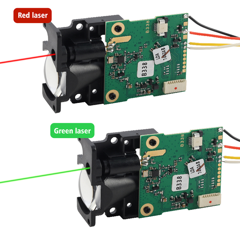
A green laser distance sensor is a measurement device that determines the distance to a target by emitting a green laser beam and analyzing the reflected signal. Compared with traditional red laser sensors, green laser sensors offer several advantages:
-
Higher visibility in bright environments
-
Better performance in outdoor applications
-
Improved targeting accuracy over long distances
-
Easier alignment for human operators
Green laser sensors typically use phase-shift or time-of-flight measurement technology, allowing them to achieve millimeter-level accuracy in short to medium-range measurement applications.
Because of these advantages, green laser sensors are widely used in industrial automation, robotics, and surveying systems where reliable and precise measurement is required.
Understanding GNSS Technology
GNSS stands for Global Navigation Satellite System, which provides location and timing information using satellite signals. The most well-known GNSS systems include GPS, GLONASS, Galileo, and BeiDou.
GNSS receivers determine the geographic position of a device by calculating the time it takes for satellite signals to reach the receiver. This allows systems to determine latitude, longitude, altitude, and time information with high accuracy.
However, GNSS alone may not always provide precise distance measurements to nearby objects. This is where a laser distance sensor integrated with GNSS becomes extremely useful.
Why Integrate a Green Laser Distance Sensor with GNSS?
Integrating a green laser distance sensor with GNSS combines two complementary technologies: precise local distance measurement and global positioning.
1. Improved Measurement Accuracy
GNSS provides accurate location coordinates, while the laser distance sensor measures the exact distance between the sensor and a target object. By combining both data sources, systems can calculate precise spatial coordinates of objects or terrain features.
2. Enhanced Surveying Efficiency
Surveying teams often need both position data and distance measurements. With a GNSS-laser integrated system, operators can obtain both measurements simultaneously, significantly improving field efficiency.
3. Better Performance in Complex Environments
In environments such as construction sites or mountainous terrain, relying solely on GNSS may lead to inaccuracies due to signal interference. A green laser distance sensor helps compensate by providing accurate short-range measurements.
4. Real-Time Data Collection
Integrated GNSS and laser measurement systems enable real-time mapping and positioning, which is essential for applications like autonomous machines, drones, and smart construction equipment.
Key Applications of Green Laser Distance Sensor with GNSS
1. Land Surveying and Mapping
Surveyors increasingly use laser distance sensors integrated with GNSS to measure terrain features, building positions, and land boundaries with higher precision. The green laser beam is easier to see outdoors, making it ideal for fieldwork.
2. UAV Mapping and Inspection
Drones equipped with GNSS and laser distance sensors can capture accurate altitude and distance data during aerial mapping missions. This improves the quality of 3D terrain models and digital elevation maps.
3. Smart Construction and Infrastructure
Modern construction equipment often uses positioning technologies for automated guidance. Integrating a high precision laser distance sensor with GNSS allows machines to determine their exact location relative to structures or terrain.
4. Precision Agriculture
Farm equipment equipped with GNSS positioning and laser sensors can measure crop height, field distance, and terrain variations. This helps farmers optimize planting, irrigation, and harvesting operations.
5. Autonomous Robotics
Autonomous robots require accurate distance and location information to navigate safely. The combination of GNSS positioning and laser measurement helps robots understand both their global location and nearby obstacles.
Advantages of Green Laser Technology in GNSS Systems
Compared with traditional red laser sensors, green laser distance sensors offer several technical advantages when integrated with GNSS platforms:
Higher visibility:
Green laser beams are easier to see under sunlight, which improves targeting and alignment.
Improved measurement reliability:
The clear visibility helps operators ensure the laser is aimed correctly at the target.
Better outdoor performance:
Green lasers often perform better in outdoor environments with strong ambient light.
These benefits make green laser sensors particularly suitable for surveying equipment, drone systems, and outdoor measurement tools.
Future Trends of Laser and GNSS Integration
The integration of laser measurement technology and GNSS positioning systems is expected to grow rapidly as industries demand higher accuracy and automation.
Future developments may include:
-
Smaller and lighter sensor modules
-
Higher measurement frequencies
-
Improved energy efficiency
-
AI-driven data processing
-
Integration with 3D LiDAR and imaging systems
As smart infrastructure, robotics, and geospatial technologies continue to evolve, laser distance sensors integrated with GNSS will play a critical role in building more intelligent and precise measurement systems.
Conclusion
The combination of green laser distance sensors and GNSS technology provides a powerful solution for high-precision positioning and distance measurement. By integrating accurate laser measurement with global positioning capabilities, engineers and surveyors can achieve more reliable spatial data in complex environments.
From land surveying and UAV mapping to smart construction and precision agriculture, the integration of these technologies is transforming how distance and location are measured in modern applications. As sensor technology continues to advance, green laser distance sensors integrated with GNSS will become even more important in the future of intelligent measurement systems.